Wildfire Science and remote sensing
Using satellite derived spectral indices to study the effects of a natural fire regime.
In 2020, I had the opportunity to volunteer with the Wildlife Ecology Division at Yosemite National Park. The team was in the midst of a multi-year study assessing how landscape ecology differs between areas that experience a natural fire regime versus a suppressed fire regime.
Background
Over the past century, most of the forests in the United States have experienced a regime of fire suppression. This means that natural fires, which would typically occur every few years to decades, have been actively prevented through firefighting efforts. As a result, these forests have accumulated dense underbrush, increased fuel loads, and an altered structure. This change has significant ecological consequences, including reduced biodiversity, and increased vulnerability to high-intensity wildfires.
In contrast, areas with a natural fire regime experience more frequent, low-intensity fires that maintain ecosystem health and resilience. Studies have shown that these areas can be more drought tolerant, increase Snow Water Equivalent (SWE), increase soil moisture, and kill insects and diseases.
The project
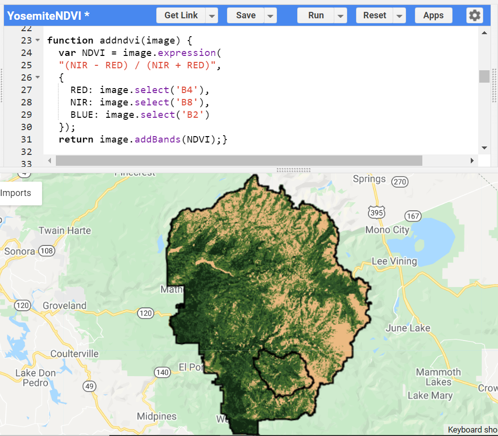
Yosmite National Park is similar to most of the western US, in that it has a long history of fire suppression. However, there are some areas within the park that have been allowed to burn naturally (Illilouette Creek Basin), providing a unique opportunity to study the effects of different fire regimes on forest health. My role in this project was to assist with the procurement and processing of spectral indices derived from Sentinel-2 satellite imagery.
Using Google Earth Engine, I developed scripts that calculated a wide list of ecologically significant spectral indices. This included NDVI, NBR, NDWI, EVI, SAVI, and many others. The goal was to then plug these indices into a statistical model to tease out any trends or relationships with forest health metrics.
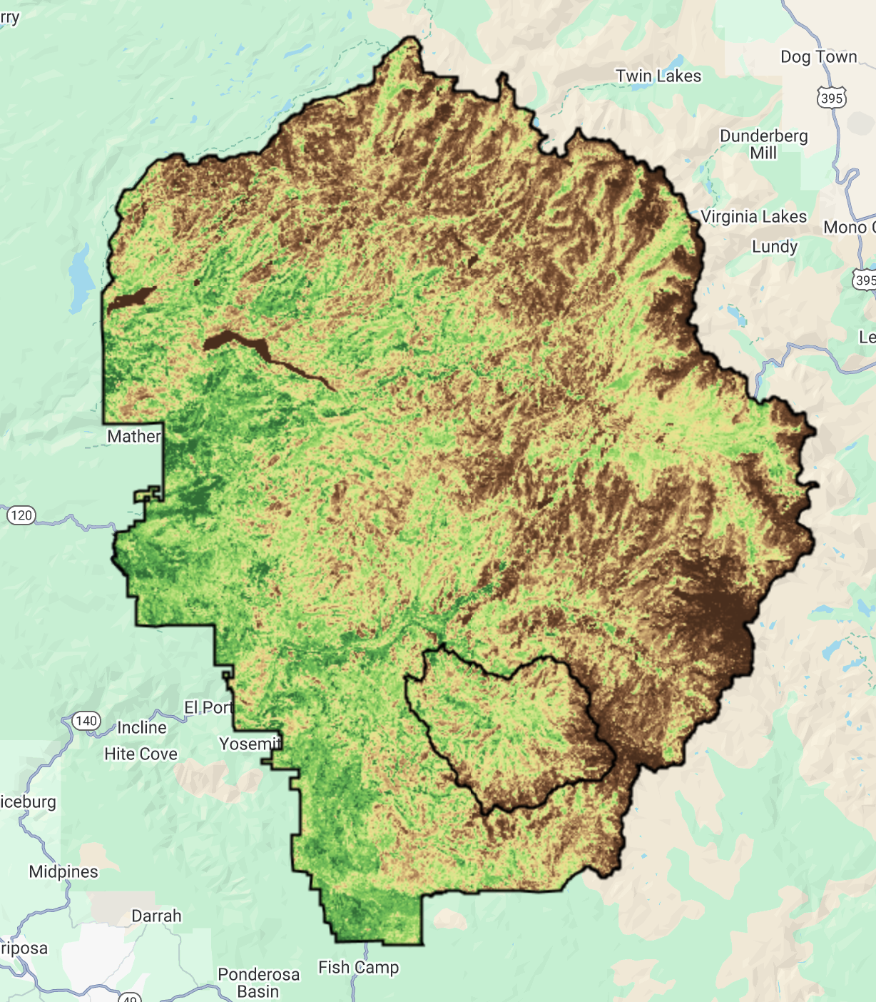
This image shows Yosemite National Park (larger polygon) and the Illilouette Creek Basin (smaller polygon) with a Sentinel-2 derived Optimized Soil Adjusted Vegetation Index (OSAVI).
The paper that the team worked on is titled "Second-Entry Burns Reduce Mid-Canopy Fuels and Create Resilient Forest Structure in Yosemite National Park, California".
You can read the study here:
https://www.mdpi.com/1999-4907/13/9/1512