Hydrology
High Resolution Hydrologic Mapping
Over the past year I was fortunate to have the opportunity to develop and lead the execution of Aero-Graphics' USGS 3DHP - Elevation Derived Hydrography contract.
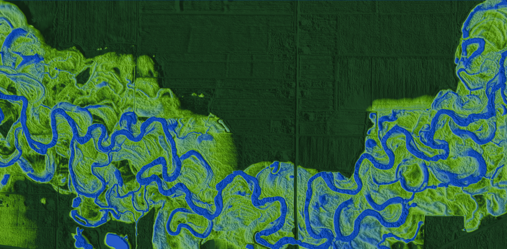
USGS' 3DHP program is the first systematic remapping of our nations hydrology since the original 1:24,000-scale topographic mapping program, which was active from 1947 to 1992. That means there has been nearly 30 years of technical advancements to support more accurate hydrological mapping efforts.
In 2013, The USGS established the 3DEP program, with the goal of achieving nationwide high-resolution lidar coverage at 4–8+ points per square meter. Today, with roughly 95% of the United States mapped under 3DEP, the need and opportunity for a modern, high-resolution hydrographic framework became obvious.
This program is special to me because it is an excellent culmination of technical skills and hydrological/ geomorphological knowledge. In the sections that follow, I outline my general approach to the work, along with key challenges I've encountered and the solutions that have proven most effective.
Tools
The EDH workflow is built around a combination of open-source GIS tools and custom Python scripts. Key tools include:
- QGIS for data visualization, manipulation, and analysis.
- Postgres/PostGIS to enforce data integrity.
- GDAL for raster(dems) data manipulation and analysis.
- WhiteboxTools for advanced terrain analysis and hydrologic modeling.
- Custom Python scripts for workflow automation, data validation, and QA/QC processes.
- GRASS GIS for robust hydrologic modeling tools (flow accumulation and strahler ordering).
Hydro-Enforcement
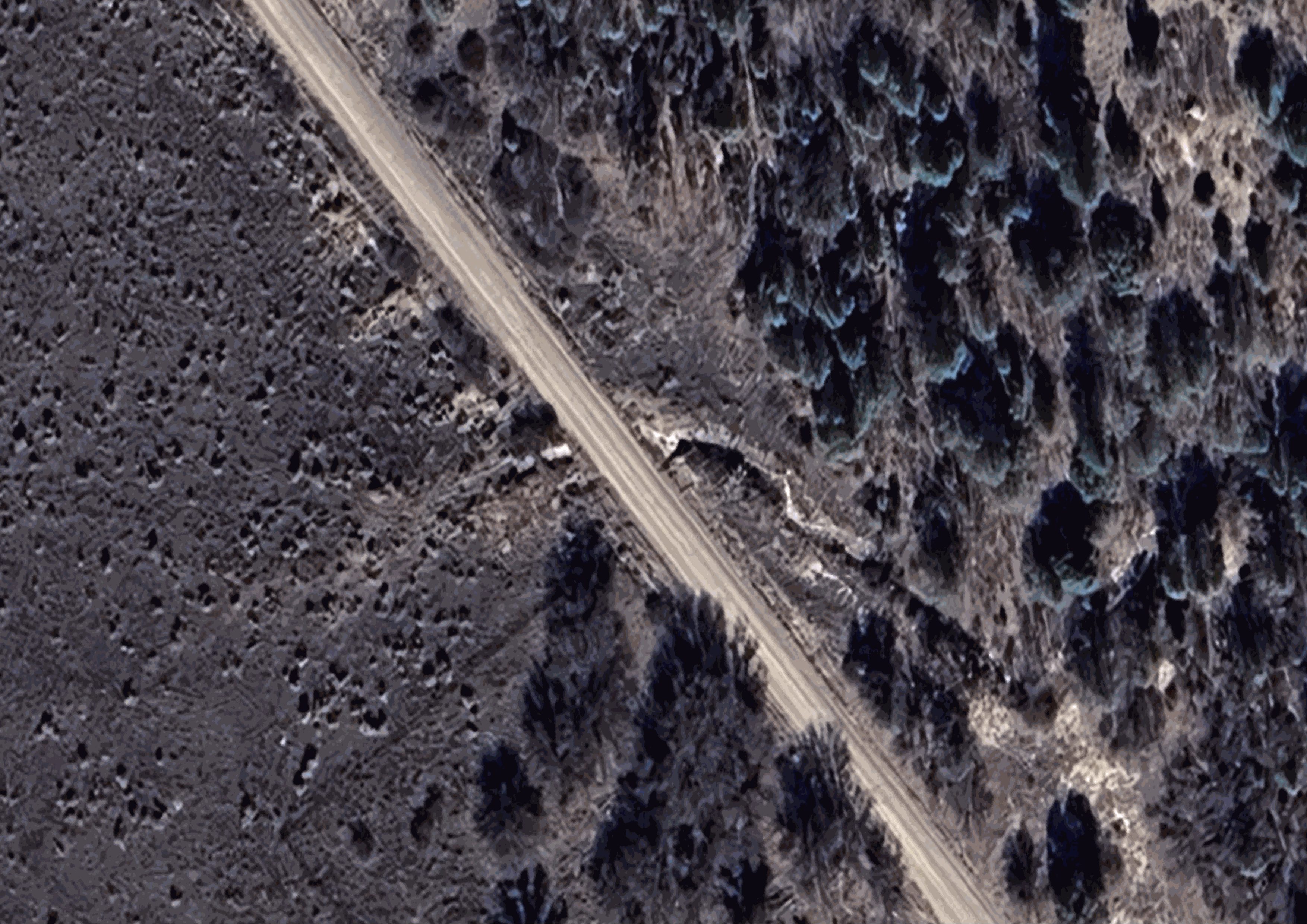
Running a flow accumulation algorithm on raw DEMs does not always produce an accurate flowline network. Water in the real world often flows in areas that LiDAR cannot reach. Obvious examples are present in built environments, namely culverts, bridges, and dams. Less obvious examples might be water flowing through dense vegetation, karst terrain, or beneath natural debris.
This shows the importance of hydro-enforcing DEMs for hydrologic mapping
Feature Classification
A critical step in the EDH workflow is the classification of hydrologic features. This includes identifying and delineating waterbodies (rivers, lakes/ponds, ocean) and flowlines (streams, canals, pipelines).
Accurate classification ensures that the derived hydrography reflects real-world conditions. This process involves a nuanced combination of algorithms, automated QC checks, and a strong eye for detail during manual review.
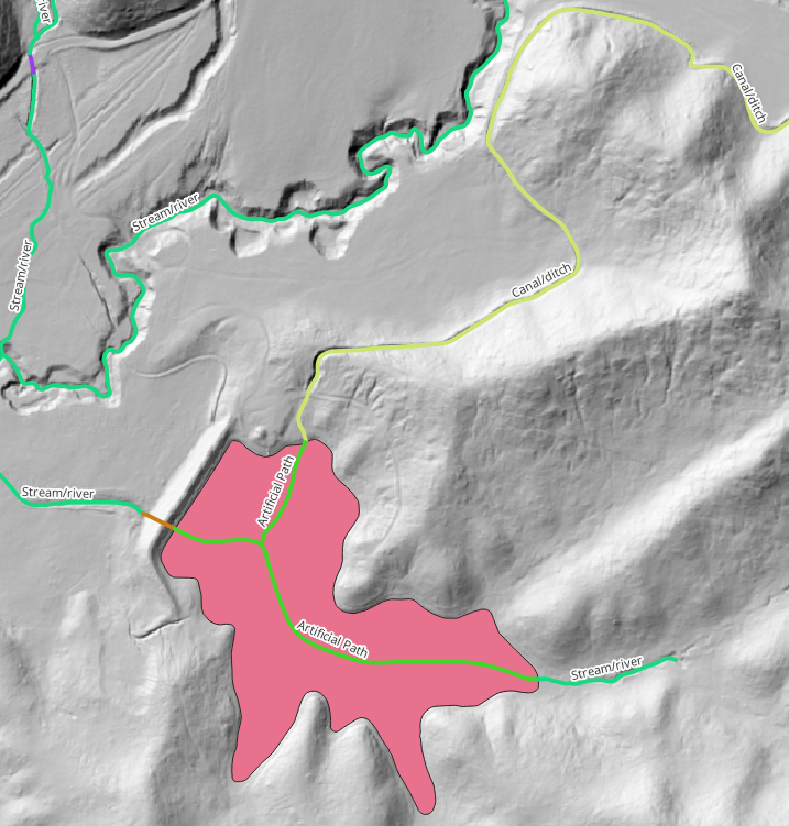
A canal draining a reservoir for irrigation
To classify river polygons, I developed a bank detection algorithm that uses a combination of slope, elevation, and flow accumulation thresholds to polygonize a river from a DEM.
1.) The first step was to derive a smoothed river centerline from the output flow accumulation algorithm.
2.) 20m transects were then programmatically generated at 5 meter intervals along the centerline.
3.) Each meter (pixel) of the transect was then sampled on a slope raster.
4.) A user defined slope threshold determined if a pixel was classified as bank or not.
5.) The bank pixels were then connected to create a river polygon.
This algorithm significantly improved the accuracy and efficiency of delineating river polygons compared to manual digitization. The results were then fed into a convolutional neural network to achieve superb bank predictions at scale.
Nuanced topological relationships between flowlines and waterbodies
Topology
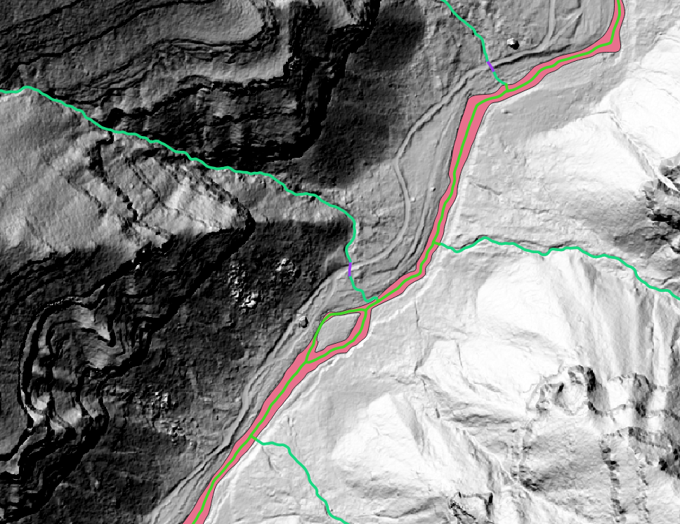
Ensuring topological correctness in the derived hydrography is paramount. Topological requirements for EDH are complex.
Flowlines must connect as a clean directed graph with all nodes touching in the X,Y, and Z dimensions, maintaining consistently downward flow within 0.001m above or 1.001m below the DEM suface (except where impossible). Lines that flow into a waterbody polygon must be split where they intersect and have a smooth appearance.
Waterbody polygons must be assigned the Z value of the outflowing vertex and must have islands ring vertices digitized in the clockwise direction if the island meets the minimum size requirement.
Knowing the depth of the topological requirements and the size of the dataset, I built a suite of QC tools and topological checks that were used throughout the lifespan of the project.
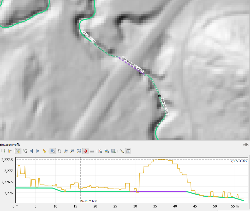
Elevation profile of DEM surface and a stream that flows beneath a road
Why it matters
High-resolution hydrography is crucial for a wide range of applications, including flood modeling, water resource management, environmental conservation, and urban planning. USGS 3DHP program which ingests the Elevation Derived Hydrography aims to provide a more accurate and detailed representation of the nation's waterways, which will allow for more informed decisions for a wide variety of stakeholders.