Historical Imagery
“The farther backward you can look, the farther forward you are likely to see.”
— W. Churchill
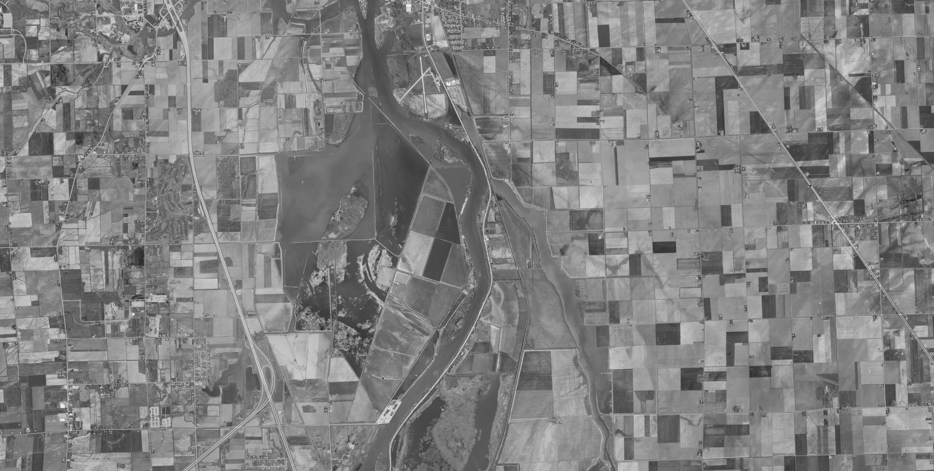
Historical orthoimagery has been one of the cornerstones of my geospatial work.
I’ve spent the last 5 years managing, processing, and delivering large scale orthoimagery collections for federal and state clients, ensuring that decades of visual history are preserved in the modern age.
The many uses of Historical Imagery
- Land and boundary disputes: documenting historical parcel boundaries, access routes, fence lines, and patterns of land use.
- Water rights and beneficial use: verifying historical irrigation extent, diversion locations, ditch alignments, and periods of active use. (Could we use SFM to model historical flow paths)
- Environmental compliance and enforcement: establishing baseline conditions for wetlands, streams, floodplains, and riparian zones.
- Channel migration and geomorphic change: tracking how rivers, shorelines, and drainage networks have shifted over time.
- Soil erosion and land degradation: identifying historical erosion patterns, sediment movement, and changes in soil stability over time.
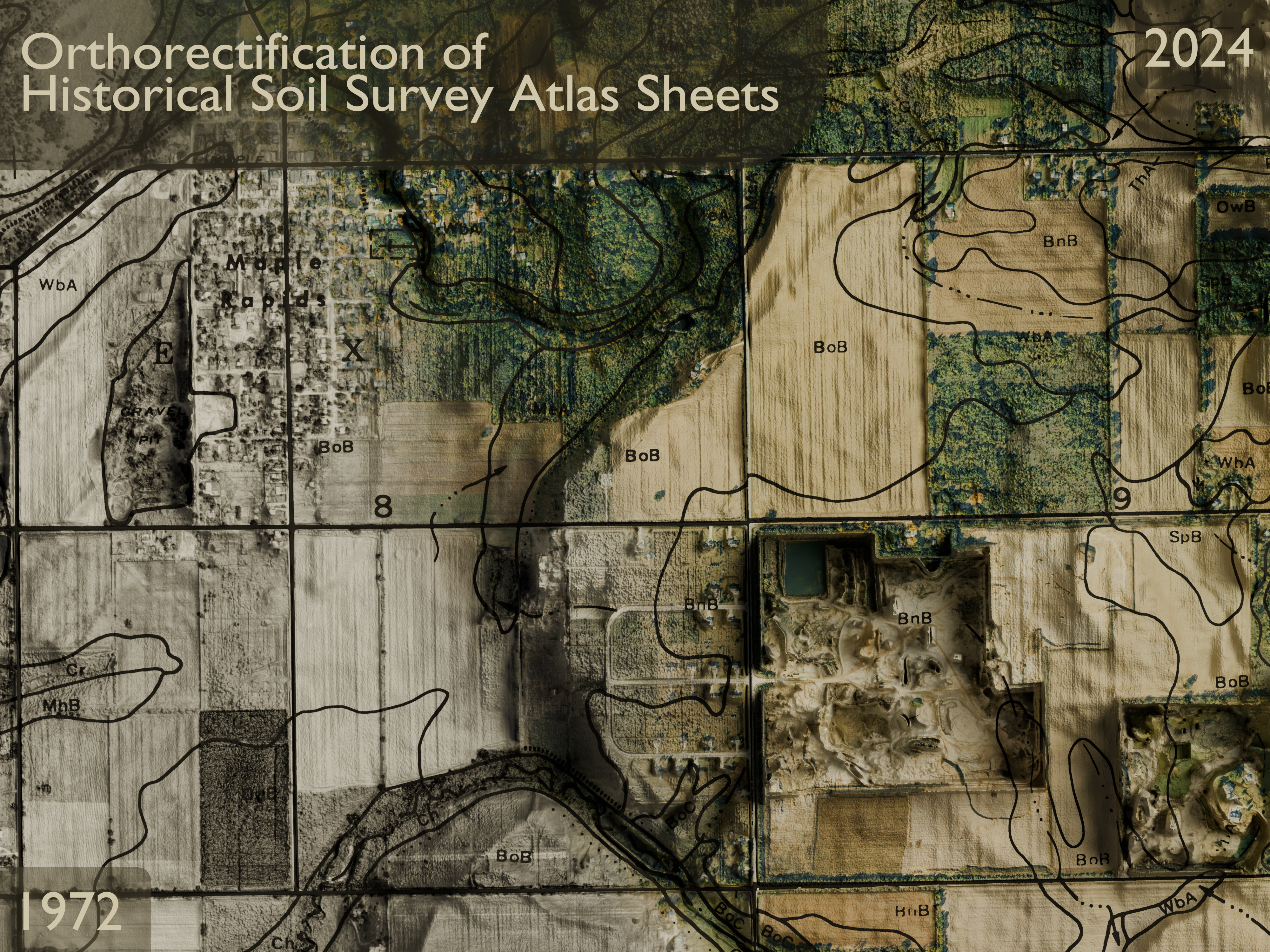
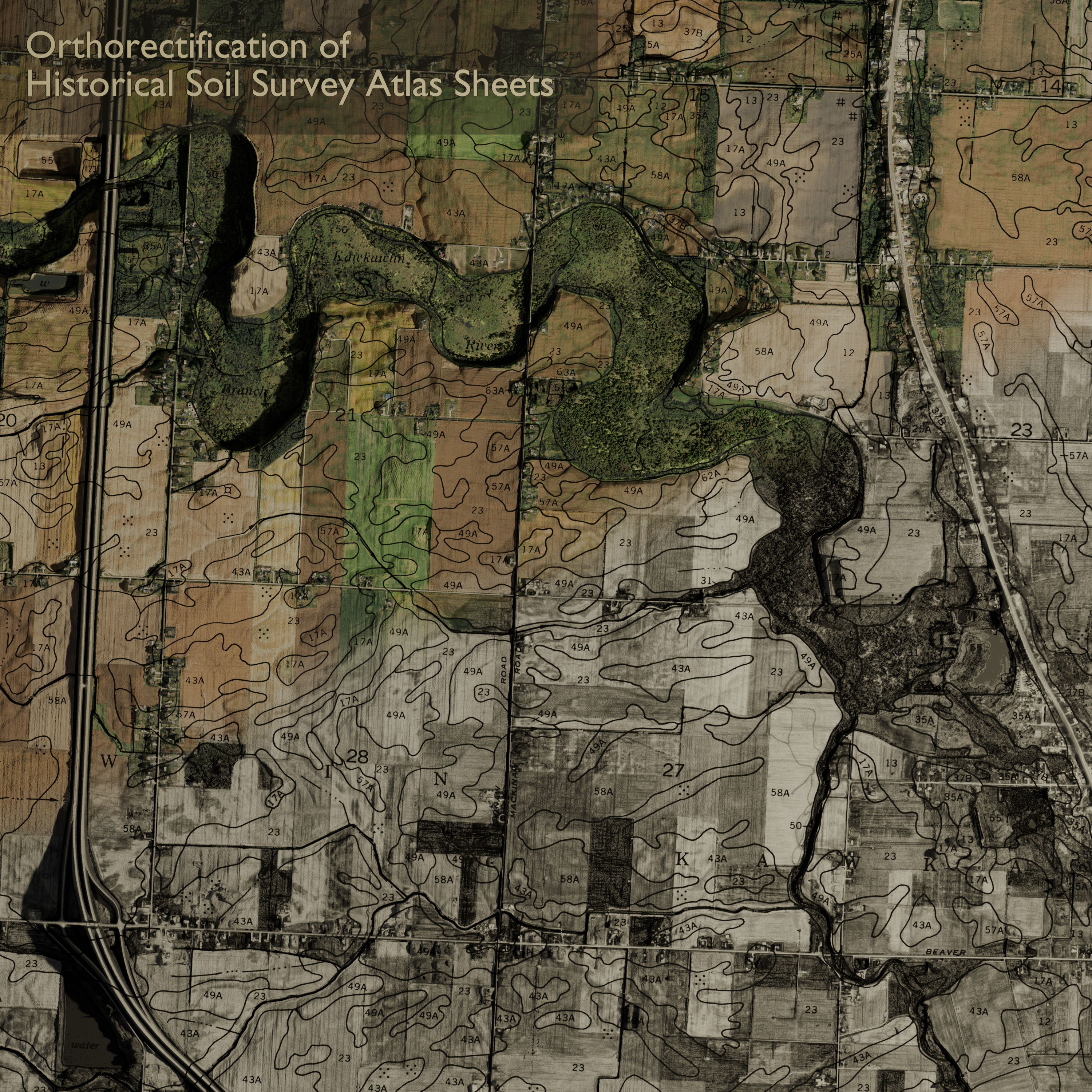
NRCS Soil Atlas Sheets
One of the more interesting projects I developed with my colleagues was orthorectifying scans from SSURGO soil atlases. In the image below, I overlaid the merged and orthorectified soil lines onto 2024 NAIP imagery (top right) fading into the historical imagery, and draped it all on a 3DEP DEM.
Historical SFM point clouds
The video below is a Structure from Motion (SFM) point cloud produced from high resolution historical aerial imagery. I brought the colorized point cloud into Blender and animated a fly through of the scene. Look closely to see if you can see the crane, oil rig, or airplane. Note: I had to decrease the resolution and length of the video dramatically to host it on the site. Feel free to contact me if you want to see the full resolution version.